We’ve copped a bit of a beating overnight — lots of lightning and thunder and now quite a bit of rain. Fortunately the wind is not fierce — yet. It’s meant to pick up later this morning.
Here’s a satellite image of our area (we’re near Bunbury) about 15 minutes ago — the pinks, blues and purples are the lightning strikes:
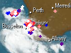
And the radar also about 15 mins ago — light green is lighter rain; yellow is heavy rain:

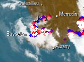
And 11 hours later… Nothing much has changed. The weather system seems to be just going around and around in the one spot and not moving out to sea or inland as it normally does. Are we in some sort of 12/12/12/ vortex? 😉 Here are the satellite and radar pictures from about 4:30 pm the same day:

However, the wind has picked up a bit and a LOT of rain has been dumped on the region. For example, Harvey has had more than 100 mm of rain, Bunbury close to 50 mm (now over 100 mm), and Myalup some 80 mm. All these places are within 30 km of where I live, so we’ve likely received between 50 and 80 mm of rain — that’s two to three inches in the old money 😉 And it’s December — we rarely get rain in December, so to get massive amounts of it is very unusual. In fact, it’s very unusual to get that sort of rainfall even in the middle of winter, which is when most of our annual rain falls.
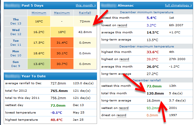
Update 13 December 2012: Just to show how much rain we’ve had in the past two days, here’s a summary of our recent days and annual averages (notice too, the temperature drop!):
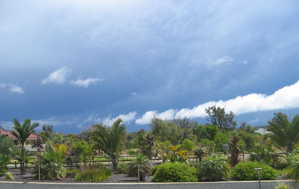
I took the photos below on December 12 (I think) in a break in the rain. You can see how heavily laden the sky is, but what I really liked was the line of bright white clouds trying to creep in 😉


Bummer! Computers and new sewing machines don’t do well in such situations!!!!! We look like a “snow globe” here. Got around 7″ on Sunday! Hugs……..
Holy moley, that radar image looks ominous. I think you should take shelter in the Bali Hut – you know that’s structurally sound now. Seriously though, I hope you come through it fine.